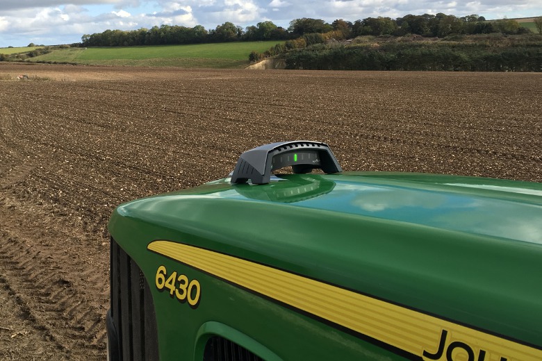
With more than 300 units already sold, the onTrak tractor GPS guidance system will make its European debut at Agritechnica. Developed by British firm Agricision, the system uses a patent-pending combined receiver and lightbar operated via an iPad or iPhone.
The company says the cost-effective (£675 + VAT) guidance solution is quick and simple to set up, easy to operate and swap between tractors or other vehicles. The GPS receiver adheres magnetically to the bonnet of the tractor, which not only places the lightbar clearly in the eyeline of the driver, but according to Agricision, also improves responsiveness since it is in line with the tractor’s front wheels rather than behind them with in-cab systems.
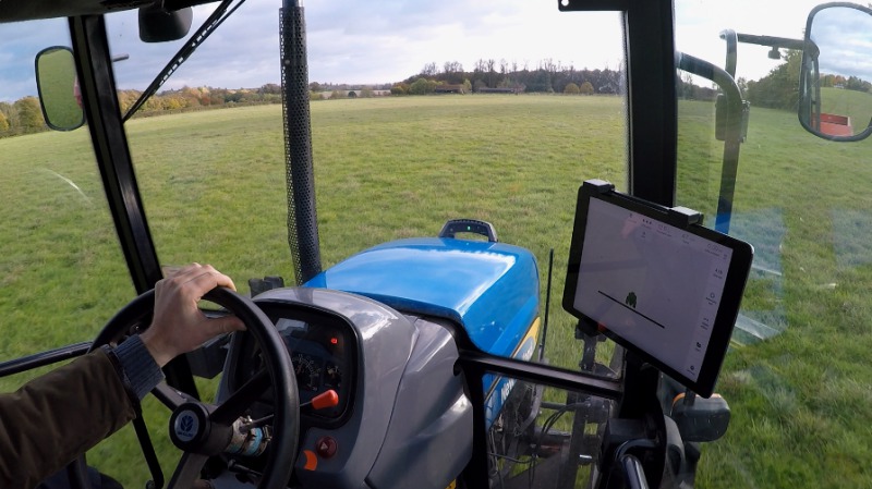
Set up and controlled via a free App downloaded to a mobile device which connects wirelessly using Bluetooth, in the field the operator inputs the implement width and sets the A-B line which creates the guidance lines. When driving on the line, a single green light shows in the centre of the lightbar with flashing or continuous red lights activated if the tractor is driven off course. GPS correction signals are obtained from any freely available satellite source, and the onboard battery, which provides the receiver with 24 hours operating capacity, is recharged via a standard USB cable.
Agricision director Adam Keene says onTrak is ideal for mixed and dairy farmers who don’t need sophisticated auto steer systems but can benefit from the increased accuracy offered by guidance. “We also see it as a useful guidance solution for tasks such as rolling or cultivating for larger arable enterprises when the most highly equipped tractors are tied-up.”
Guidance records can be stored against a field name for future use before moving onto the next field, and guidance can be paused to refill a sprayer or spreader for example, resuming when returning to the stop point. A new onTrak.Cloud service has been added that will allow customers to gain access to their data recorded and created while using onTrak in simple mode. Field boundaries and recorded work can be visualised on Google Earth or other mapping software and fields imported into management tools such as Gatekeeper.
“There are any number of management software packages available to farmers and our aim is to make the data recorded from onTrak as simple and open as possible, allowing customers the flexibility to work with whichever system they prefer,” adds Mr Keene. “With a simple integration with iCloud the user can access their field data anywhere anytime.” The company is offering a free trial period for all customers, after which a subscription will be payable for the onTrak cloud service.
An internet connection will be required for synchronisation to the cloud but the onTrak app will store the data until a connection is available so the operator can continue to work. Free to all users, a new feature has also been built into the basic app which allows a user to visualise the field and area worked on a satellite image in real time.